Sorry for the quality of pics, all I have is my EVO and a cheap point+shoot.
We covered 200+ miles of backcountry roads in the 4Runner
Highway leading into DVNP

First view of the Death Valley Basin

Saw tons of rusted out cars that had been pushed off the road/abandoned. With so little humidity and rust out here metal seems to last forever as we will later see at the mine ruins and ghost towns throughout the valley.

Panamint mountain range

Great picture, screwed up by the antenna. Plan to photoshop this out eventually.

Adios paved road

HELLA NOR*CAL

Weaved through lots of tight canyons

Beautiful vistas everywhere you looked. Surrounded by 11,000ft mountain ranges. The CottonWoods, Last Chance Range, Panamint Range, Grapevine mountains, etc etc.

Not much is known about ol' James McKay. He lies buried here outside the entrance to an old mine in the ghost town of Chloride City. We visited him on Christmas day. I figured ol' James would like some company today.

Death Valley is littered with old abandon mines, up until the govt stepped in this place was mined for gold, silver, borax, lead you name it they found it in DV and tore the place apart trying to find more. Most of the mines have been dug out so much the ground is unstable above them and could collapse on you if you attempt to play around in them. Cyanide was a common agent in the process of breaking down the ore. Lots of it floating around in the air in the mines. We of course went in them anyway.


Christmas Day at the summit of Chloride Cliffs!


My mom bought my gf all this designer stuff, leather gloves, feather lined earmuffs, and some crazy sequined beret. Lookin' classy in the desert.

I got a SPOT GPS rescue device, works almost anywhere in the world. They will come rescue your dumb ass if you get hurt/lost/kidnapped. Please only use this in case of an emergency folks. Its a serious tool.

Entrance into Eureka Valley, sadly I could not get a good shot of it with the cheapo P+S camera. It was one of the most breathtaking sights I have ever seen.

Bands of color in the Grapevine mountains sit next to the yellow sands of the Eureka dunes (highest dunes in CA, around 700ft)

Camped at the base of the dunes. BAD CALL! Desert winds kicked up right after the sun went down, burned up all our wood trying to stay warm, then out of nowhere it started RAINING! I did not bring the fly as I had not expected to encounter rain in the desert. Rookie mistake. We grabbed up our sleeping bags and crashed in the truck for the night. The wind would not stop and it was driving us insane. I turned on the headlights and peered out into the desert, It was like we were on the moon. The tent had 3 inches of sand on the floor in the AM, Thank God for the truck.


More shots of the Eureka Dunes


Road got a little sketch through DeDecker canyon, had to airdown and keep it in 4-Lo to climb some dry waterfalls. Made it alright but was a bit concerned about getting stuck. At this point we are about 50 miles away from any help whatsover. No cell phone signal

The truck ran like a champ and made it up the falls on its second attempt. Toyota 4x4 is awesome.

Came across our first Joshua tree, looks like Dr. Seuss made it. There was a large grove up around the bend

Beautiful drive into the valley

A wild burro approaches

SUP


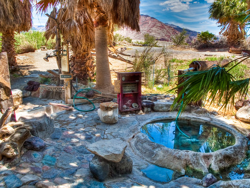
Drove through the Saline Valley hot springs, I did not get any pics here but it a naturally occurring spring in the middle of the desert. A bunch of desert rats maintain this area and it is a gorgeous oasis in the middle of nowhere, complete with hottubs, showers, bathrooms, kitchen, etc. Springs are clothing optional, bunch of old timers walking around naked.

BATROCK ROAD junction, some cool old scrapmetal art out in the desert to indicate where to turn from one dirt road to another to get to the springs

Saline valley dunes, smaller but still impressive. We took the time to walk out and have a look.


If you look close you can see the oasis of the warm springs just over the top of the middle dune

Find the 4Runner

Made it out of the valley and decided to head up the Eastern Sierras to see some more snow

Saw some sled dogs

and last but not least, Mono lake just outside Tioga pass looking back towards the Sierra Nevadas/Yosemite area. The formations are called Tufas and are formed by underground springs leaving deposits behind as they bubble up from the lake bottom. LA decided it needed the water more than the lake did and drained alot leaving behind these formations above water. This has since been remedied and the lake is slowly rising once again.

No comments:
Post a Comment
Note: Only a member of this blog may post a comment.